
Starting from the carpark at Burrough we headed north across the fields that run along the country parks eastern boarder. After these the path plunges off the edge of the hill and down into woodland.

This woodland leads east for a couple of km before bringing you back to the hill edge at Punch Bowl Covert.

The climb up Punch Bowl Covert is steep.

Once ontop of the hill again the path marches endlessly southwards through fields of dwarf corn onto the distant spire of Somerby Church.

After quickly passing through the village of Somerby you are presented with a view across a valley to Owston and the hills beyond. The stream you cross hear drains westward towards the Soar and thus enters the sea by the River Humber. Owston marks the watershed where water starts draining eastwards toward the Wash.

The view forward shows the east leicestershire hills from the north. The picture above shows Colborough Hill. This is one of the easier hills to recognise because of the wood that half covers it.
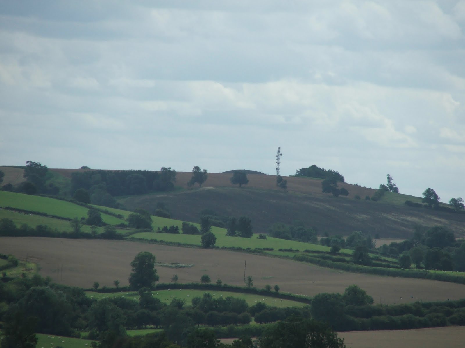
One of the tallest hills is slightly harder to spot from this perspective. Whatborough Hill at 230m is one of the tallest but lacks features. A discerning eye might be able to spot the dome of a Severn Trent water reservoir that sits at the top of it. The third hill of the trio sits just behind these and so can't be seen from the north.

Considering the fact that we were now walking across the ironstone upland in the east of the county the views westward were nearly always obscured. Once or twice you could see a reasonable distance, like in the photo to Beacon Hill (above).

Owston is an all to brief punctuation mark of civilisation.

It is becoming more and more apparent that the season is maturing. The sloe berries abound.

A few more fields and the northern horizon darkens. Owston Wood creeps ever closer like a green tidal wave. The footpath cuts through the wood. The stream that you cross here drains into Rutland Water to the east.

Now, the guide book said the wood was very, very wet but surely in summer it would have dried out? That is what I thought before we entered. The reality was exactly as the guide book suggested. The wooded path was unbelievably wet. The soil was like soup. Great ankle deep and water filled footprints betrayed a recent history of walkers almost loosing their boots. The path was at quite a slope and yet the water did not seem to be able to drain away. It was bazaar. I commented at the time that it was like water sticking to a 45 degree slope.

After clearing the wood, we then went through Withcote Hall farm. Where we were investigated by piglets, horses and my worst nightmare - an untethered Alsation. It was one of those run or fight moments. We stood our ground and I did my best "Hello friendly dog, good boy, good boy" and it seemed to do the trick.

Being the other side of the wood now allows you to see the third hill in the trio called Robin a tiptoe hill. This flat topped hill is distinctive because it is so flat topped. It is also prominent from the A47.

Colborough Hill from the east is quite obvious also. Whatborough is obscurred by the woodland from here.

This picture shows the "three peaks" of Leicestershire's Jurrasic ridge. Robin-a-Tiptoe Hill on the left, Colborough Hill in the middle and Whatborough on the right. All three have been a hillfort at some point in the past. Its just a shame no right of way was established up any of these hills.

The path now crosses a few more fields and the River Chater. This river misses Rutland Water and drains streight into the Welland and out into the wash.

The days walk ended at Launde Abbey. This impressive Tudor house is now a retreat house owned by the Diocese of Leicester. Its a tremendously peaceful place.
No comments:
Post a Comment